
Point of Vue People’s Choice 2024: Here are the nominees for Services
May 16, 2024
Teen burned, raped and shot; mother and boyfriend arrested, sheriff says
May 16, 2024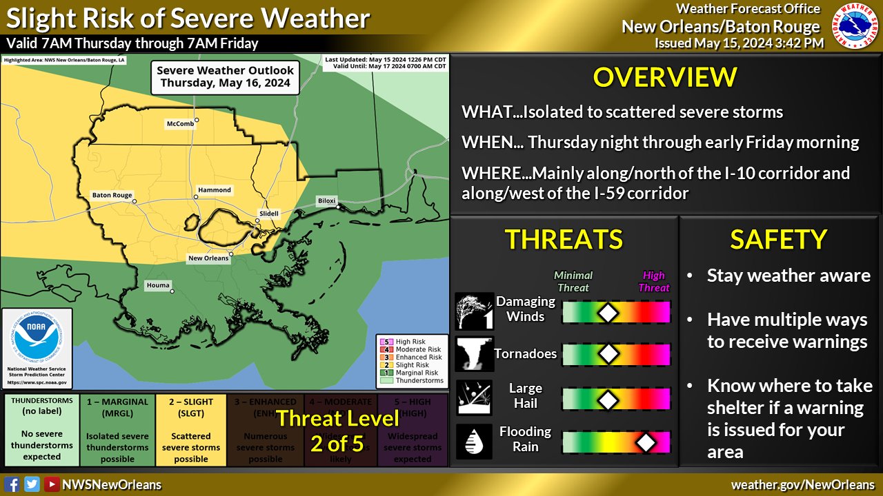
The Governor’s Office of Homeland Security and Emergency Preparedness (GOHSEP) is encouraging everyone to stay weather aware as we face another round of potentially dangerous weather beginning tonight, with additional rounds in the forecast through Saturday. The GOHSEP Crisis Action Team will be monitoring any support requests from our local emergency managers.
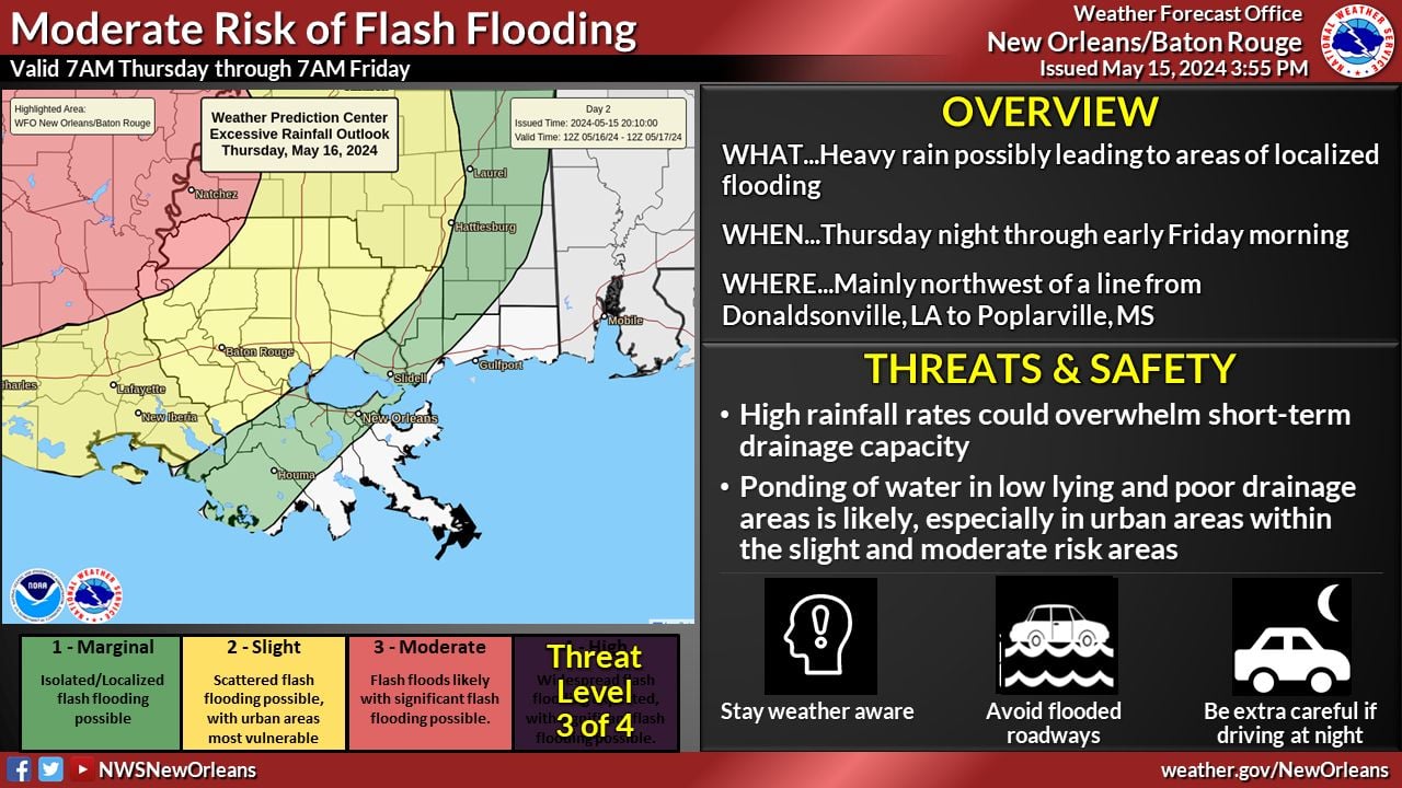
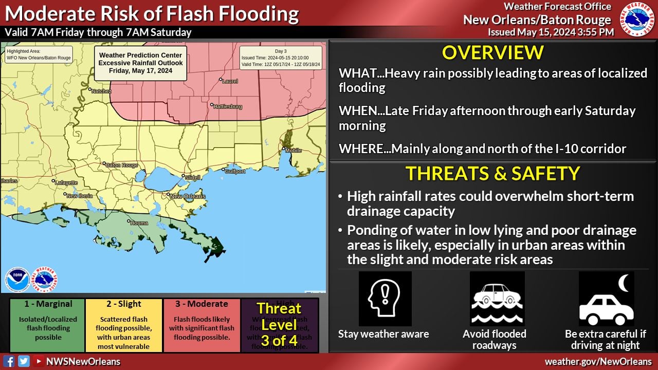
The National Weather Service (NWS) has placed a portion of the state from the Texas-Louisiana line through areas in Southwest Louisiana and Central Louisiana in a HIGH risk for excessive rainfall. From 2010 through 2022, only 4% of days were given a HIGH RISK warning by the NWS Storm Prediction Center (SPC).
33% of all flood-related fatalities occurred on those HIGH RISK days.
80% of flood-related damages occurred on HIGH RISK days. Most were associated with Hurricane Harvey.
There are marginal to moderate excessive rainfall risks for the rest of the state.
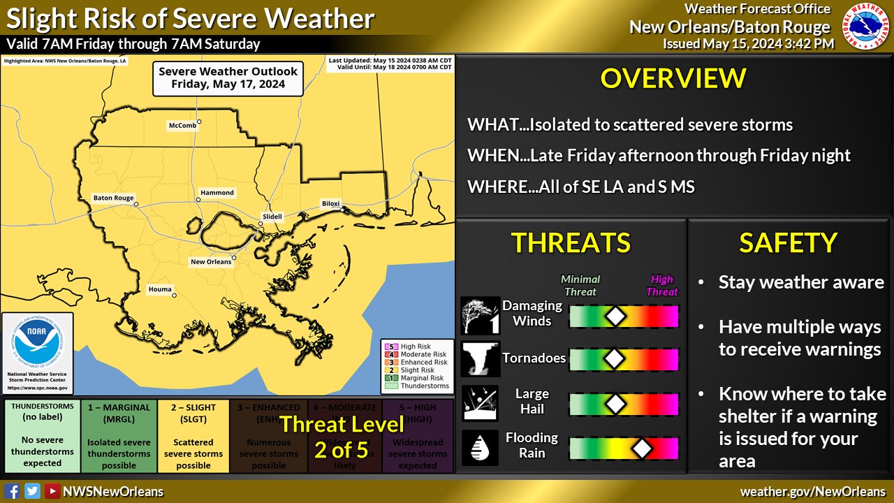
There is also a threat of severe weather associated with these storms. The threats include possible tornadoes, wind damage and hail.
As always, take advantage of the time before the storms to prepare. Keep your devices charged in order to receive potential weather alerts. Follow any potential information from your local leaders, emergency managers and first responders. Please do not drive on flooded roadways. Remember the message from our transportation partners- Turn Around, Don’t Drown.
Check the forecast from your local weather experts and following the four NWS offices that cover Louisiana:
NWS Lake Charles
NWS Shreveport
NWS New Orleans
And NWS Jackson, MS

