
TPCG warns of utilities billing scam
June 18, 2021
Partnership Will Bring 7,000 Hot Meals to Summer Camp Programs
June 18, 2021
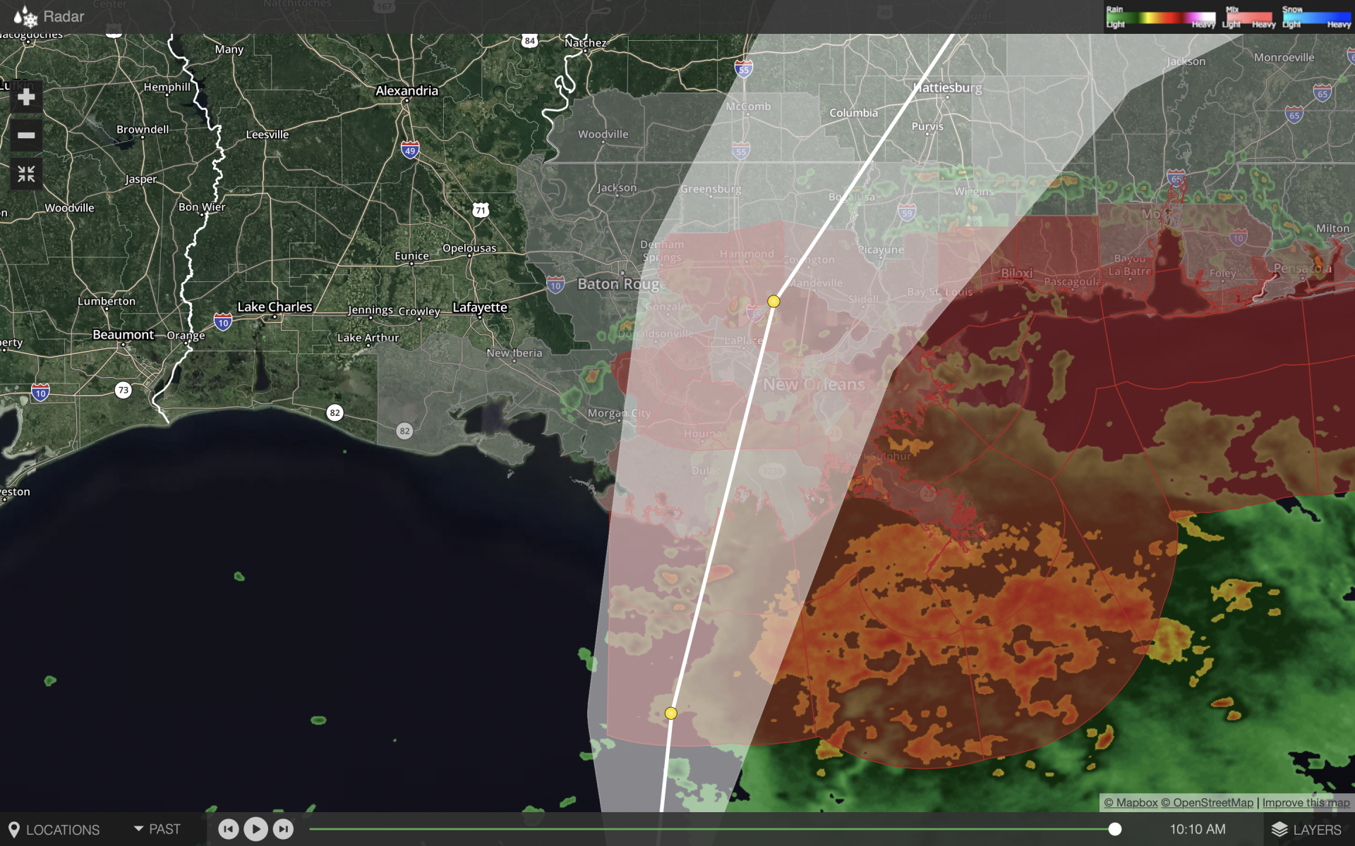
With the 10 a.m. update, Potential Tropical Cyclone Three is still moving quickly towards the Louisiana and Mississippi coast. Rain bands from the system have started making their way onshore. The system is about 220 miles from Morgan City, Louisiana, and is moving north at 14 mph.
The Tropical Storm Warning has been discontinued from Morgan City westward to Intracoastal City, Louisiana.
A Tropical Storm Warning is still in effect for East of Morgan City, Louisiana to the Okaloosa/Walton County line Florida, Lake Pontchartrain, Lake Maurepas, and Metropolitan New Orleans.
A Flash Flood Watch is in effect for portions of southeast Louisiana and Mississippi, including Terrebonne and Lafourche.
At 1000 AM CDT (1500 UTC), the disturbance was centered near latitude 26.5 North, longitude 91.1 West. The system is moving toward the north-northeast near 14 mph (22 km/h) and this general motion is expected for the next day or so. On the forecast track, the system will make landfall along the north-central Gulf Coast tonight or early Saturday. A slow northeastward motion across the southeastern United States is likely after landfall through the weekend.
Maximum sustained winds are near 35 mph (55 km/h) with higher gusts. Some strengthening is forecast, and a subtropical or tropical storm is likely to form over the central or northern Gulf of Mexico later today.
* Formation chance through 48 hours…high…90 percent.
* Formation chance through 5 days…high…90 percent.
The estimated minimum central pressure based on data from the Air Force Hurricane Hunters and surface observations is 1007 mb (29.74 inches).

