
Hurricane Watch issued as Francine closes in
September 10, 2024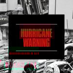
Hurricane Watch becomes Hurricane Warning with Storm Surge Warning
September 10, 2024
With this update, a Hurricane Warning is now in effect for the Louisiana coast east of Morgan City to Grand Isle. Tropical Storm Francine is excepted to become a hurricane today, making landfall on Wednesday. While winds are currently near 65 mph, significant strengthening is expected before it reaches our coast.

At 7:00 AM CDT (1200 UTC), the center of Tropical Storm Francine was located near latitude 24.5 North, longitude 95.9 West. Francine is moving toward the north near 5 mph (7 km/h). A slow northward motion is expected through this morning, followed by a turn to the northeast with an increase in forward speed. On the forecast track, Francine is anticipated to be just offshore of the coasts of northeastern Mexico and southern Texas through today, and make landfall in Louisiana on Wednesday.
Maximum sustained winds are near 65 mph (100 km/h) with higher gusts. Francine will likely become a hurricane today, with significant strengthening expected before it reaches the coast.
 Tropical-storm-force winds extend outward up to 140 miles (220 km) from the center.
The minimum central pressure just reported by a NOAA Hurricane Hunter aircraft is 990 mb (29.23 inches).
Next complete advisory at 10:00 AM CDT.

